 SKY
SKY
Current Status
Where is the vessel?
SKY is currently in Near Laurium (Lavrion), based on AIS data received about 14h ago.
Latest AIS update:
Current position: 37.71098° N, 24.07693° E (Near Laurium (Lavrion))
Average speed (last 7 days): Loading…
Average speed (last 30 days): Loading…
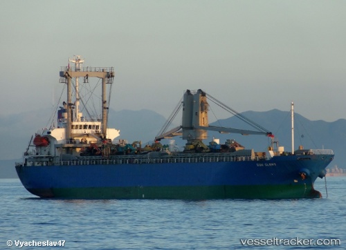
Vessel profile: SKY is a Cargo with dimensions m x m.
This page combines live AIS, route history, probable destination signals, nearby traffic, and port activity for practical vessel monitoring.
The current position of vessel SKY is 37.71098 lat / 24.07693 lng. Updated: 2026-05-23 13:23:15 UTCNearest reference points:
- Near LAVRIO
- Near LAVRIO MARINA
- Near Kéa (Tzia)
Currently sailing under the flag of Palau ![]()
Details:
Live Vessel SKY Analytics (details, animations, etc.)
Recent AIS points (UTC):
2026-05-23 09:35:16 UTC · 37.71098, 24.07710 · SOG 0.1 kn · COG -1°2026-05-23 10:11:16 UTC · 37.71095, 24.07721 · SOG 0.1 kn · COG -1°
2026-05-23 11:38:14 UTC · 37.71102, 24.07692 · SOG 0 kn · COG -1°
2026-05-23 13:23:15 UTC · 37.71098, 24.07693 · SOG 0.1 kn · COG -1°