 vesseltracker.com
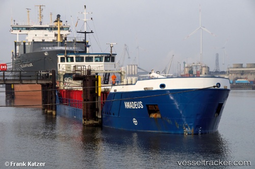
 Amadeus
Current Status
Where is the vessel?
Amadeus is currently in 79 nm N of Carino, based on AIS data received less than 1h ago.
Latest AIS update:
Current position: 44.97804° N, 8.46892° W (79 nm N of Carino)
Average speed (last 7 days): Loading…
Average speed (last 30 days): Loading…
Vessel profile: Amadeus is a General Cargo Ship with dimensions 80m x 10m.
This page combines live AIS, route history, probable destination signals, nearby traffic, and port activity for practical vessel monitoring.
The current position of vessel Amadeus is 44.97804 lat / -8.46892 lng. Updated: 2026-05-14 18:03:11 UTCNearest reference points:
- 57 nm S of Boboras
- 22 nm N of Carino
- 30 nm NW of Meiras-Valdoviño
Currently sailing under the flag of St Vincent Grenadines ![]()
Amadeus built in 2001 year
Deadweight:
1680 tDetails:
Live Vessel Amadeus Analytics (details, animations, etc.)
Recent AIS points (UTC):
2026-05-14 14:06:33 UTC · 44.59500, -8.74333 · SOG 6 kn · COG -1°2026-05-14 15:33:32 UTC · 44.73833, -8.63833 · SOG 6 kn · COG -1°
2026-05-14 16:33:36 UTC · 44.83833, -8.56833 · SOG 5 kn · COG -1°
2026-05-14 18:03:11 UTC · 44.97804, -8.46892 · SOG 6.4 kn · COG 21°