 vesseltracker.com
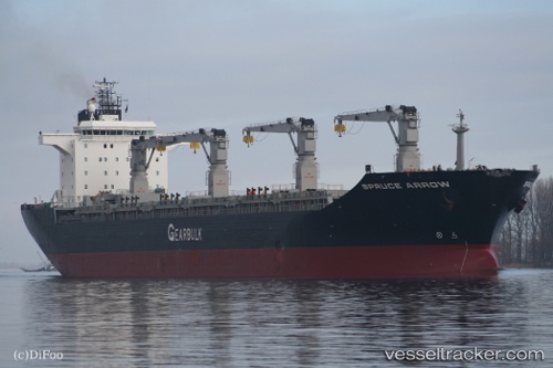
 Spruce Arrow
Current Status
Where is the vessel?
Spruce Arrow is currently in 125 nm N of Antofagasta, based on AIS data received less than 1h ago.
Latest AIS update:
Current position: 21.58687° S, 70.07796° E (125 nm N of Antofagasta)
Average speed (last 7 days): Loading…
Average speed (last 30 days): Loading…
Vessel profile: Spruce Arrow is a Multi Purpose Carrier with dimensions 189m x 190m.
This page combines live AIS, route history, probable destination signals, nearby traffic, and port activity for practical vessel monitoring.
The current position of vessel Spruce Arrow is -21.58687 lat / 70.07796 lng. Updated: 2026-04-24 17:41:40 UTCNearest reference points:
- 249 nm E of Rodrigues
- 255 nm E of Rodrigues
Currently sailing under the flag of Bahamas ![]()
Spruce Arrow built in 2002 year
Deadweight:
47792 tDetails:
Live Vessel Spruce Arrow Analytics (details, animations, etc.)
Recent AIS points (UTC):
2026-04-24 14:24:39 UTC · -21.73178, 69.54887 · SOG 9.3 kn · COG 77°2026-04-24 15:22:01 UTC · -21.69130, 69.70436 · SOG 9.4 kn · COG 74°
2026-04-24 16:28:38 UTC · -21.63782, 69.87987 · SOG 9.3 kn · COG 75°
2026-04-24 17:41:40 UTC · -21.58687, 70.07796 · SOG 9.2 kn · COG 74°