 vesseltracker.com
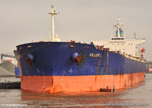
Kalliopi L
Current StatusWhere is the vessel?
Kalliopi L is currently in 351 nm SE of Frégate, based on AIS data received less than 1h ago.
Latest AIS update:
Current position: 9.20833° S, 59.54167° E (351 nm SE of Frégate)
Average speed (last 7 days): Loading…
Average speed (last 30 days): Loading…
Vessel profile: Kalliopi L is a Self Discharging Bulk Carrier with dimensions 32m x 224m.
This page combines live AIS, route history, probable destination signals, nearby traffic, and port activity for practical vessel monitoring.
The current position of vessel Kalliopi L is -9.20833 lat / 59.54167 lng. Updated: 2026-05-14 11:23:29 UTCNearest reference points:
- Open sea, approx. 402 nm off the nearest listed port
- Open sea, approx. 408 nm off the nearest listed port
- Open sea, approx. 403 nm off the nearest listed port
Details:
Live Vessel Kalliopi L Analytics (details, animations, etc.)
Recent AIS points (UTC):
2026-05-14 08:20:09 UTC · -8.66372, 59.65518 · SOG 11 kn · COG 187°2026-05-14 09:47:28 UTC · -8.92333, 59.60333 · SOG 10 kn · COG -1°
2026-05-14 10:47:35 UTC · -9.10333, 59.56500 · SOG 11 kn · COG -1°
2026-05-14 11:23:29 UTC · -9.20833, 59.54167 · SOG 10 kn · COG -1°