 vesseltracker.com
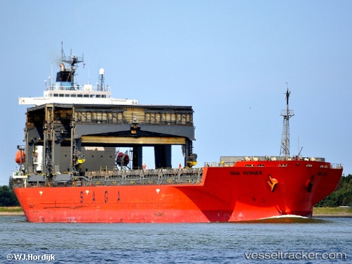
 SAGA VOYAGER
Current Status
Where is the vessel?
SAGA VOYAGER is currently in 22 nm S of West Bank, based on AIS data received about 1h ago.
Latest AIS update:
Current position: 33.36837° S, 28.05800° E (22 nm S of West Bank)
Average speed (last 7 days): Loading…
Average speed (last 30 days): Loading…
Vessel profile: SAGA VOYAGER is a General Cargo with dimensions m x m.
This page combines live AIS, route history, probable destination signals, nearby traffic, and port activity for practical vessel monitoring.
The current position of vessel SAGA VOYAGER is -33.36837 lat / 28.05800 lng. Updated: 2026-05-14 16:09:34 UTCNearest reference points:
- Near Deal Party
- 23 nm E of Port Saint John's
Currently sailing under the flag of Bahamas ![]()
Details:
Live Vessel SAGA VOYAGER Analytics (details, animations, etc.)
Recent AIS points (UTC):
2026-05-14 13:33:24 UTC · -33.06243, 28.45735 · SOG 10.2 kn · COG 217°2026-05-14 13:55:44 UTC · -33.10882, 28.40355 · SOG 9.9 kn · COG 228°
2026-05-14 16:04:54 UTC · -33.35870, 28.07173 · SOG 11 kn · COG 229°
2026-05-14 16:09:34 UTC · -33.36837, 28.05800 · SOG 11.6 kn · COG 229°