 vesseltracker.com
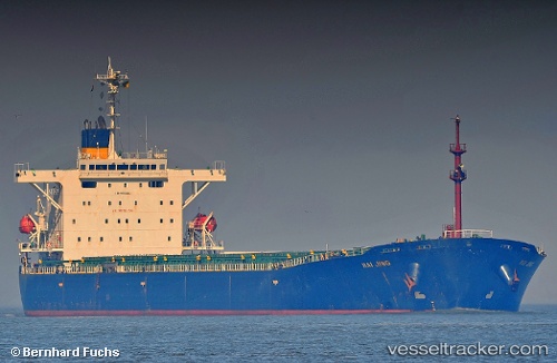
 TANG LAND
Current Status
Where is the vessel?
TANG LAND is currently in Near Ruch’I, based on AIS data received less than 1h ago.
Latest AIS update:
Current position: 59.76947° N, 28.43532° E (Near Ruch’I)
Average speed (last 7 days): Loading…
Average speed (last 30 days): Loading…
Vessel profile: TANG LAND is a Bulk Carrier with dimensions 33m x 225m.
This page combines live AIS, route history, probable destination signals, nearby traffic, and port activity for practical vessel monitoring.
The current position of vessel TANG LAND is 59.76947 lat / 28.43532 lng. Updated: 2026-05-14 09:37:17 UTCNearest reference points:
- Near Ruch’I
- Near VISTINO
- Near Ust-Luga
Currently sailing under the flag of Panama ![]()
TANG LAND built in 2001 year
Deadweight:
75928 tDetails:
Live Vessel TANG LAND Analytics (details, animations, etc.)
Recent AIS points (UTC):
2026-05-14 05:58:38 UTC · 59.76938, 28.43461 · SOG 0.2 kn · COG 183°2026-05-14 07:19:38 UTC · 59.76947, 28.43460 · SOG 0 kn · COG 182°
2026-05-14 07:25:38 UTC · 59.76948, 28.43461 · SOG 0 kn · COG 182°
2026-05-14 09:37:17 UTC · 59.76947, 28.43532 · SOG 0.3 kn · COG 182°