 vesseltracker.com
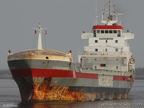
 Virginiaborg
Current Status
Where is the vessel?
Virginiaborg is currently in 22 nm N of El Jadida, based on AIS data received about 1h ago.
Latest AIS update:
Current position: 33.60799° N, 8.39926° W (22 nm N of El Jadida)
Average speed (last 7 days): Loading…
Average speed (last 30 days): Loading…
Vessel profile: Virginiaborg is a General Cargo Ship with dimensions 132m x 16m.
This page combines live AIS, route history, probable destination signals, nearby traffic, and port activity for practical vessel monitoring.
The current position of vessel Virginiaborg is 33.60799 lat / -8.39926 lng. Updated: 2026-05-14 10:17:59 UTCNearest reference points:
- 21 nm NW of El Jadida
- Near Jorf Lasfar
- 54 nm N of El Jadida
Currently sailing under the flag of Netherlands ![]()
Virginiaborg built in 2001 year
Deadweight:
9600 tDetails:
Live Vessel Virginiaborg Analytics (details, animations, etc.)
Recent AIS points (UTC):
2026-05-14 05:52:31 UTC · 34.31731, -7.74518 · SOG 12 kn · COG 218°2026-05-14 09:22:50 UTC · 33.75888, -8.26483 · SOG 12.3 kn · COG 215°
2026-05-14 10:17:59 UTC · 33.60799, -8.39926 · SOG 12 kn · COG 216°
2026-05-14 10:17:59 UTC · 33.60799, -8.39926 · SOG 12 kn · COG 216°