 vesseltracker.com
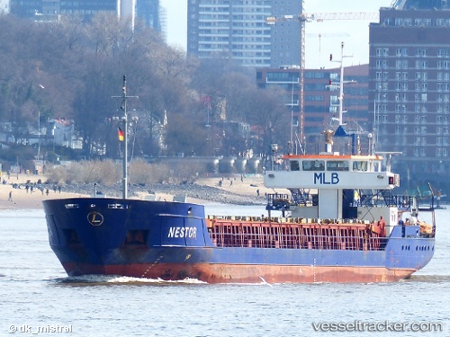
 Nestor
Current Status
Where is the vessel?
Nestor is currently in Near Stavanger, based on AIS data received less than 1h ago.
Latest AIS update:
Current position: 58.94741° N, 5.75305° E (Near Stavanger)
Average speed (last 7 days): Loading…
Average speed (last 30 days): Loading…
Vessel profile: Nestor is a Multi Purpose Carrier with dimensions 90m x 12m.
This page combines live AIS, route history, probable destination signals, nearby traffic, and port activity for practical vessel monitoring.
The current position of vessel Nestor is 58.94741 lat / 5.75305 lng. Updated: 2026-05-15 11:43:54 UTCNearest reference points:
- Near Lura
- Near Egersund
- Near HUSOYA
Currently sailing under the flag of Antigua Barbuda ![]()
Nestor built in 2000 year
Deadweight:
2500 tDetails:
Live Vessel Nestor Analytics (details, animations, etc.)
Recent AIS points (UTC):
2026-05-15 07:38:06 UTC · 58.94746, 5.75302 · SOG 0 kn · COG 135°2026-05-15 10:01:36 UTC · 58.94743, 5.75302 · SOG 0 kn · COG 135°
2026-05-15 10:16:27 UTC · 58.94745, 5.75295 · SOG 0 kn · COG 135°
2026-05-15 11:43:54 UTC · 58.94741, 5.75305 · SOG 0 kn · COG 135°