 vesseltracker.com
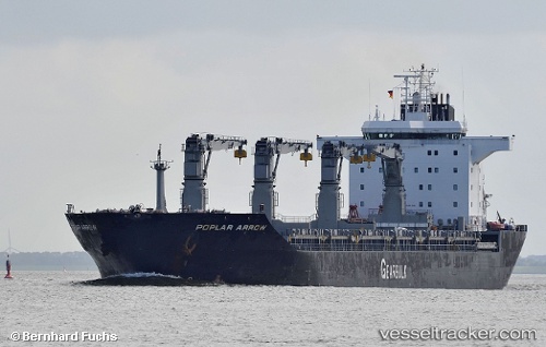
Poplar Arrow
Current StatusWhere is the vessel?
Poplar Arrow is currently in 27 nm E of WEDA, based on AIS data received about 15h ago.
Latest AIS update:
Current position: 0.21437° N, 128.30740° E (27 nm E of WEDA)
Average speed (last 7 days): Loading…
Average speed (last 30 days): Loading…
Vessel profile: Poplar Arrow is a Multi Purpose Carrier with dimensions 30m x 190m.
This page combines live AIS, route history, probable destination signals, nearby traffic, and port activity for practical vessel monitoring.
The current position of vessel Poplar Arrow is 0.21437 lat / 128.30740 lng. Updated: 2026-04-27 02:34:33 UTCNearest reference points:
- 13 nm NE of WEDA
- Near TERNATE
- 55 nm S of Labuha, Molucas
Details:
Live Vessel Poplar Arrow Analytics (details, animations, etc.)
Recent AIS points (UTC):
2026-04-27 02:34:33 UTC · 0.21437, 128.30740 · SOG 12.8 kn · COG 316°2026-04-27 02:34:33 UTC · 0.21437, 128.30740 · SOG 12.8 kn · COG 316°
2026-04-27 02:34:33 UTC · 0.21437, 128.30740 · SOG 12.8 kn · COG 316°
2026-04-27 02:34:33 UTC · 0.21437, 128.30740 · SOG 12.8 kn · COG 316°