 vesseltracker.com
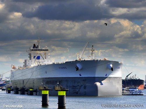
 SA EUROPE
Current Status
Where is the vessel?
SA EUROPE is currently in Near TANJUNG PELEPAS, based on AIS data received about 1h ago.
Latest AIS update:
Current position: 1.28237° N, 103.42200° E (Near TANJUNG PELEPAS)
Average speed (last 7 days): Loading…
Average speed (last 30 days): Loading…
Vessel profile: SA EUROPE is a Crude Oil Tanker with dimensions m x m.
This page combines live AIS, route history, probable destination signals, nearby traffic, and port activity for practical vessel monitoring.
The current position of vessel SA EUROPE is 1.28237 lat / 103.42200 lng. Updated: 2026-04-25 23:32:27 UTCNearest reference points:
- Near Tanjong Bin
- 15 nm W of Tanjong Bin
- Near Nipah
Currently sailing under the flag of Bahamas ![]()
Details:
Live Vessel SA EUROPE Analytics (details, animations, etc.)
Recent AIS points (UTC):
2026-04-25 20:08:31 UTC · 1.28400, 103.42218 · SOG 0 kn · COG 115°2026-04-25 22:08:44 UTC · 1.28287, 103.42192 · SOG 0 kn · COG 93°
2026-04-25 22:23:23 UTC · 1.28280, 103.42195 · SOG 0 kn · COG 92°
2026-04-25 23:32:27 UTC · 1.28237, 103.42200 · SOG 0 kn · COG 85°