 vesseltracker.com
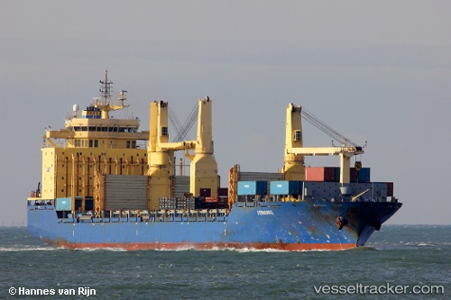
Yu Chang
Current StatusWhere is the vessel?
Yu Chang is currently in 13 nm W of Colombo, based on AIS data received less than 1h ago.
Latest AIS update:
Current position: 7.02030° N, 79.64915° E (13 nm W of Colombo)
Average speed (last 7 days): Loading…
Average speed (last 30 days): Loading…
Vessel profile: Yu Chang is a Multi Purpose Carrier with dimensions 28m x 192m.
This page combines live AIS, route history, probable destination signals, nearby traffic, and port activity for practical vessel monitoring.
The current position of vessel Yu Chang is 7.02030 lat / 79.64915 lng. Updated: 2026-04-30 05:05:28 UTCNearest reference points:
- 19 nm SW of Bataduwa
- 67 nm SW of Moratuwa
- 82 nm W of Moratuwa
Details:
Live Vessel Yu Chang Analytics (details, animations, etc.)
Recent AIS points (UTC):
2026-04-30 01:17:27 UTC · 7.02012, 79.64850 · SOG 0.2 kn · COG 170°2026-04-30 02:14:25 UTC · 7.02013, 79.64870 · SOG 0 kn · COG 168°
2026-04-30 03:47:25 UTC · 7.02028, 79.64923 · SOG 0 kn · COG 186°
2026-04-30 05:05:28 UTC · 7.02030, 79.64915 · SOG 0.3 kn · COG 186°