 vesseltracker.com
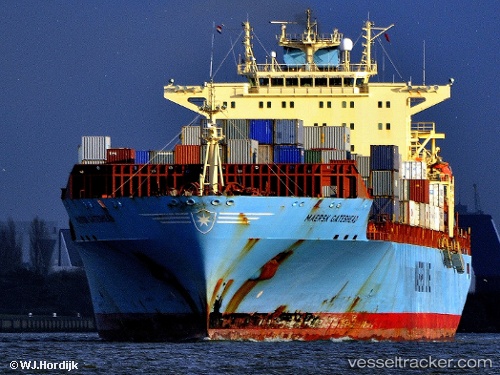
Maersk Gateshead
Current StatusWhere is the vessel?
Maersk Gateshead is currently in 32 nm NE of Corolla, based on AIS data received less than 1h ago.
Latest AIS update:
Current position: 36.74567° N, 75.34289° W (32 nm NE of Corolla)
Average speed (last 7 days): Loading…
Average speed (last 30 days): Loading…
Vessel profile: Maersk Gateshead is a Container Ship with dimensions 32m x 292m.
This page combines live AIS, route history, probable destination signals, nearby traffic, and port activity for practical vessel monitoring.
The current position of vessel Maersk Gateshead is 36.74567 lat / -75.34289 lng. Updated: 2026-04-25 06:14:24 UTCNearest reference points:
- 26 nm E of Corolla
- 45 nm NE of Nags Head
- 48 nm E of Nags Head
Details:
Live Vessel Maersk Gateshead Analytics (details, animations, etc.)
Recent AIS points (UTC):
2026-04-25 01:48:04 UTC · 36.70725, -75.31452 · SOG 0.3 kn · COG 109°2026-04-25 04:18:14 UTC · 36.72878, -75.33106 · SOG 0.6 kn · COG 248°
2026-04-25 04:29:54 UTC · 36.73073, -75.33153 · SOG 0.5 kn · COG 260°
2026-04-25 06:14:24 UTC · 36.74567, -75.34289 · SOG 0.7 kn · COG 224°