 vesseltracker.com
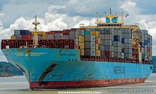
 Maersk Garonne
Current Status
Where is the vessel?
Maersk Garonne is currently in 183 nm W of Jonesville, based on AIS data received less than 1h ago.
Latest AIS update:
Current position: 39.35486° N, 57.31991° W (183 nm W of Jonesville)
Average speed (last 7 days): Loading…
Average speed (last 30 days): Loading…
Vessel profile: Maersk Garonne is a Container Ship with dimensions 292m x 292m.
This page combines live AIS, route history, probable destination signals, nearby traffic, and port activity for practical vessel monitoring.
The current position of vessel Maersk Garonne is 39.35486 lat / -57.31991 lng. Updated: 2026-05-14 21:55:30 UTCNearest reference points:
- 153 nm NW of Jonesville
- 260 nm W of Jonesville
Currently sailing under the flag of Singapore ![]()
Maersk Garonne built in 2003 year
Deadweight:
61636 tDetails:
Live Vessel Maersk Garonne Analytics (details, animations, etc.)
Recent AIS points (UTC):
2026-05-14 19:06:47 UTC · 39.52638, -56.34017 · SOG 17.2 kn · COG 256°2026-05-14 20:18:25 UTC · 39.45256, -56.77352 · SOG 17.1 kn · COG 258°
2026-05-14 21:08:20 UTC · 39.40563, -57.06361 · SOG 16.1 kn · COG 253°
2026-05-14 21:55:30 UTC · 39.35486, -57.31991 · SOG 14.6 kn · COG 253°