 vesseltracker.com
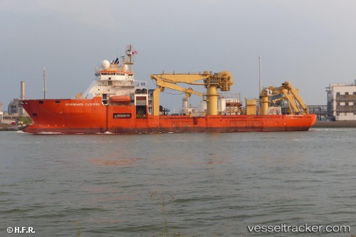
 Normand Clipper
Current Status
Where is the vessel?
Normand Clipper is currently in 28 nm N of Kikaishima, based on AIS data received less than 1h ago.
Latest AIS update:
Current position: 28.75864° N, 130.17337° E (28 nm N of Kikaishima)
Average speed (last 7 days): Loading…
Average speed (last 30 days): Loading…
Vessel profile: Normand Clipper is a Pipe Layer with dimensions 127m x 27m.
This page combines live AIS, route history, probable destination signals, nearby traffic, and port activity for practical vessel monitoring.
The current position of vessel Normand Clipper is 28.75864 lat / 130.17337 lng. Updated: 2026-05-14 21:20:29 UTCNearest reference points:
- 18 nm W of Koniya
- 71 nm SW of Taniyama
- Near YAMAGAWA
Currently sailing under the flag of Norway ![]()
Normand Clipper built in 2001 year
Deadweight:
10243 tDetails:
Live Vessel Normand Clipper Analytics (details, animations, etc.)
Recent AIS points (UTC):
2026-05-14 17:23:18 UTC · 28.36667, 130.62500 · SOG 8 kn · COG -1°2026-05-14 19:26:18 UTC · 28.56500, 130.38834 · SOG 8 kn · COG -1°
2026-05-14 19:54:20 UTC · 28.61109, 130.33359 · SOG 8.8 kn · COG 319°
2026-05-14 21:20:29 UTC · 28.75864, 130.17337 · SOG 8 kn · COG 314°