 vesseltracker.com
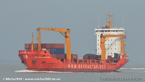
 AKHISAR
Current Status
Where is the vessel?
AKHISAR is currently in 60 nm NW of Jarjis, based on AIS data received less than 1h ago.
Latest AIS update:
Current position: 34.11915° N, 12.03331° W (60 nm NW of Jarjis)
Average speed (last 7 days): Loading…
Average speed (last 30 days): Loading…
Vessel profile: AKHISAR is a Container Ship with dimensions m x m.
This page combines live AIS, route history, probable destination signals, nearby traffic, and port activity for practical vessel monitoring.
The current position of vessel AKHISAR is 34.11915 lat / -12.03331 lng. Updated: 2026-05-14 06:02:58 UTCNearest reference points:
- 25 nm SW of Jarjis
- 34 nm N of Jarjis
- 104 nm W of Jarjis
Currently sailing under the flag of Liberia ![]()
Details:
Live Vessel AKHISAR Analytics (details, animations, etc.)
Recent AIS points (UTC):
2026-05-14 01:35:08 UTC · 34.80347, -11.60739 · SOG 10.2 kn · COG 206°2026-05-14 03:01:37 UTC · 34.58214, -11.74329 · SOG 10.2 kn · COG 207°
2026-05-14 03:39:02 UTC · 34.48607, -11.80154 · SOG 10.2 kn · COG 206°
2026-05-14 06:02:58 UTC · 34.11915, -12.03331 · SOG 10.1 kn · COG 206°