 vesseltracker.com
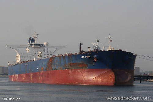
 TINA 5
Current Status
Where is the vessel?
TINA 5 is currently in 33 nm E of Kakap Natuna Terminal, based on AIS data received less than 1h ago.
Latest AIS update:
Current position: 4.93594° N, 106.49667° E (33 nm E of Kakap Natuna Terminal)
Average speed (last 7 days): Loading…
Average speed (last 30 days): Loading…
Vessel profile: TINA 5 is a Crude Oil Tanker with dimensions m x m.
This page combines live AIS, route history, probable destination signals, nearby traffic, and port activity for practical vessel monitoring.
The current position of vessel TINA 5 is 4.93594 lat / 106.49667 lng. Updated: 2026-05-14 15:38:28 UTCNearest reference points:
- 45 nm E of Kakap Natuna Terminal
- 46 nm E of Kakap Natuna Terminal
- 36 nm SW of Slipi
Currently sailing under the flag of Vanuatu ![]()
Details:
Live Vessel TINA 5 Analytics (details, animations, etc.)
Recent AIS points (UTC):
2026-05-14 12:20:10 UTC · 5.33777, 106.84943 · SOG 9.4 kn · COG 225°2026-05-14 13:29:08 UTC · 5.20492, 106.72444 · SOG 10.1 kn · COG 223°
2026-05-14 14:25:38 UTC · 5.08948, 106.62434 · SOG 10.2 kn · COG 221°
2026-05-14 15:38:28 UTC · 4.93594, 106.49667 · SOG 10.4 kn · COG 219°