 vesseltracker.com
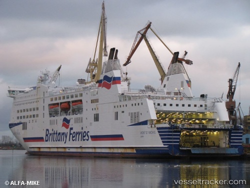
 Mont Saint Michel
Current Status
Where is the vessel?
Mont Saint Michel is currently in 14 nm NW of Saint-Martin-du-Manoir, based on AIS data received less than 1h ago.
Latest AIS update:
Current position: 49.69819° N, 0.48760° W (14 nm NW of Saint-Martin-du-Manoir)
Average speed (last 7 days): Loading…
Average speed (last 30 days): Loading…
Vessel profile: Mont Saint Michel is a Passenger Ro Ro Cargo Ship with dimensions 183m x 183m.
This page combines live AIS, route history, probable destination signals, nearby traffic, and port activity for practical vessel monitoring.
The current position of vessel Mont Saint Michel is 49.69819 lat / -0.48760 lng. Updated: 2026-05-14 23:48:25 UTCNearest reference points:
- Near Port-en-Bessin-Huppain
- Near PORT EN BESSIN
- Near Caen
Currently sailing under the flag of France ![]()
Mont Saint Michel built in 2002 year
Deadweight:
5579 tDetails:
Live Vessel Mont Saint Michel Analytics (details, animations, etc.)
Recent AIS points (UTC):
2026-05-14 19:50:11 UTC · 49.28868, -0.24717 · SOG 1.6 kn · COG 14°2026-05-14 22:24:46 UTC · 49.45432, -0.31135 · SOG 11.6 kn · COG 341°
2026-05-14 22:56:54 UTC · 49.54988, -0.37764 · SOG 11.7 kn · COG 341°
2026-05-14 23:48:25 UTC · 49.69819, -0.48760 · SOG 11.9 kn · COG 342°