 vesseltracker.com
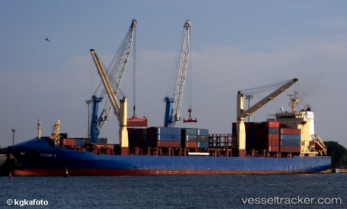
 LILA HAREN
Current Status
Where is the vessel?
LILA HAREN is currently in 121 nm NE of Kralendijk, based on AIS data received about 1h ago.
Latest AIS update:
Current position: 13.12862° N, 66.45196° W (121 nm NE of Kralendijk)
Average speed (last 7 days): Loading…
Average speed (last 30 days): Loading…
Vessel profile: LILA HAREN is a Container Ship with dimensions m x m.
This page combines live AIS, route history, probable destination signals, nearby traffic, and port activity for practical vessel monitoring.
The current position of vessel LILA HAREN is 13.12862 lat / -66.45196 lng. Updated: 2026-05-14 13:40:13 UTCNearest reference points:
- 148 nm N of Dorp Rincón
- 15 nm SW of Punta de Piedras
Currently sailing under the flag of Liberia ![]()
Details:
Live Vessel LILA HAREN Analytics (details, animations, etc.)
Recent AIS points (UTC):
2026-05-14 11:09:59 UTC · 13.34333, -66.89833 · SOG 11 kn · COG -1°2026-05-14 11:49:09 UTC · 13.29167, -66.78167 · SOG 11 kn · COG -1°
2026-05-14 13:25:23 UTC · 13.15167, -66.49333 · SOG 12 kn · COG -1°
2026-05-14 13:40:13 UTC · 13.12862, -66.45196 · SOG 11.3 kn · COG 118°