 vesseltracker.com
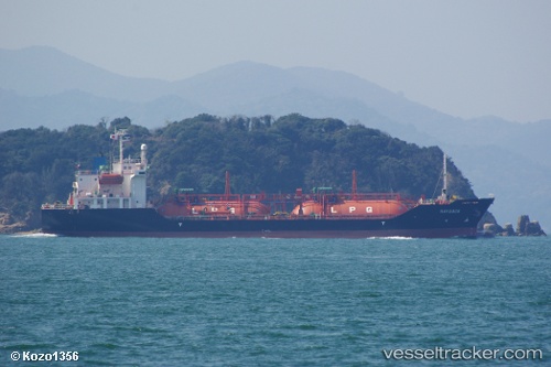
 GAS LAURA
Current Status
Where is the vessel?
GAS LAURA is currently in 19 nm NE of Kualatanjung, based on AIS data received less than 1h ago.
Latest AIS update:
Current position: 3.47333° N, 99.76833° E (19 nm NE of Kualatanjung)
Average speed (last 7 days): Loading…
Average speed (last 30 days): Loading…
Vessel profile: GAS LAURA is a LPG Tanker with dimensions 17m x 100m.
This page combines live AIS, route history, probable destination signals, nearby traffic, and port activity for practical vessel monitoring.
The current position of vessel GAS LAURA is 3.47333 lat / 99.76833 lng. Updated: 2026-05-14 17:02:30 UTCNearest reference points:
- 43 nm NE of Perbaungan
- 11 nm W of Pangkur
- 10 nm NE of Belawan
Currently sailing under the flag of Indonesia ![]()
GAS LAURA built in 2001 year
Deadweight:
4313 tDetails:
Live Vessel GAS LAURA Analytics (details, animations, etc.)
Recent AIS points (UTC):
2026-05-14 13:29:08 UTC · 3.04647, 100.27973 · SOG 12 kn · COG 308°2026-05-14 14:24:20 UTC · 3.15833, 100.13667 · SOG 11 kn · COG -1°
2026-05-14 15:56:49 UTC · 3.34667, 99.91667 · SOG 10 kn · COG -1°
2026-05-14 17:02:30 UTC · 3.47333, 99.76833 · SOG 10 kn · COG -1°