 vesseltracker.com
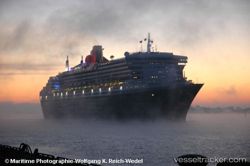
 Rms Queen Mary 2
Current Status
Where is the vessel?
Rms Queen Mary 2 is currently in 13 nm SE of Porthoustock, based on AIS data received less than 1h ago.
Latest AIS update:
Current position: 49.87993° N, 4.85560° W (13 nm SE of Porthoustock)
Average speed (last 7 days): Loading…
Average speed (last 30 days): Loading…
Vessel profile: Rms Queen Mary 2 is a Cruise Ship with dimensions 345m x 41m.
This page combines live AIS, route history, probable destination signals, nearby traffic, and port activity for practical vessel monitoring.
The current position of vessel Rms Queen Mary 2 is 49.87993 lat / -4.85560 lng. Updated: 2026-05-14 18:10:18 UTCNearest reference points:
- Near Cadgwith
- Near Flushing
- Near Falmouth
Currently sailing under the flag of Bermuda ![]()
Rms Queen Mary 2 built in 2003 year
Deadweight:
19189 tDetails:
Live Vessel Rms Queen Mary 2 Analytics (details, animations, etc.)
Recent AIS points (UTC):
2026-05-14 14:05:54 UTC · 49.60027, -7.12417 · SOG 22.4 kn · COG 82°2026-05-14 15:40:30 UTC · 49.63058, -6.21104 · SOG 22.6 kn · COG 86°
2026-05-14 16:35:09 UTC · 49.71471, -5.71481 · SOG 22.2 kn · COG 76°
2026-05-14 18:10:18 UTC · 49.87993, -4.85560 · SOG 21.8 kn · COG 71°