 vesseltracker.com
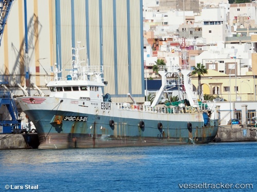
Farruco
Current StatusWhere is the vessel?
Farruco is currently in 234 nm E of Puerto Deseado, based on AIS data received less than 1h ago.
Latest AIS update:
Current position: 46.45240° S, 60.51663° W (234 nm E of Puerto Deseado)
Average speed (last 7 days): Loading…
Average speed (last 30 days): Loading…
Vessel profile: Farruco is a Fishing Vessel with dimensions 10m x 52m.
This page combines live AIS, route history, probable destination signals, nearby traffic, and port activity for practical vessel monitoring.
The current position of vessel Farruco is -46.45240 lat / -60.51663 lng. Updated: 2026-04-25 21:44:05 UTCDetails:
Live Vessel Farruco Analytics (details, animations, etc.)
Recent AIS points (UTC):
2026-04-25 17:41:54 UTC · -46.20108, -60.48477 · SOG 4 kn · COG 187°2026-04-25 19:28:04 UTC · -46.31475, -60.47100 · SOG 3.9 kn · COG 189°
2026-04-25 19:50:06 UTC · -46.33686, -60.47763 · SOG 3.7 kn · COG 200°
2026-04-25 21:44:05 UTC · -46.45240, -60.51663 · SOG 3.9 kn · COG 203°