 vesseltracker.com
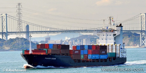
Harbour Star
Current StatusWhere is the vessel?
Harbour Star is currently in Near Muara, based on AIS data received about 2h ago.
Latest AIS update:
Current position: 5.09383° N, 115.09600° E (Near Muara)
Average speed (last 7 days): Loading…
Average speed (last 30 days): Loading…
Vessel profile: Harbour Star is a Container Ship with dimensions 19m x 133m.
This page combines live AIS, route history, probable destination signals, nearby traffic, and port activity for practical vessel monitoring.
The current position of vessel Harbour Star is 5.09383 lat / 115.09600 lng. Updated: 2026-04-30 04:27:13 UTCNearest reference points:
- Near Kikeh
- 11 nm N of MIRI
- 44 nm SW of Tembungo
Details:
Live Vessel Harbour Star Analytics (details, animations, etc.)
Recent AIS points (UTC):
2026-04-30 02:03:13 UTC · 5.09350, 115.09783 · SOG 0 kn · COG 316°2026-04-30 02:03:13 UTC · 5.09350, 115.09783 · SOG 0 kn · COG 316°
2026-04-30 03:57:13 UTC · 5.09333, 115.09733 · SOG 0.1 kn · COG 344°
2026-04-30 04:27:13 UTC · 5.09383, 115.09600 · SOG 0.1 kn · COG 52°