 vesseltracker.com
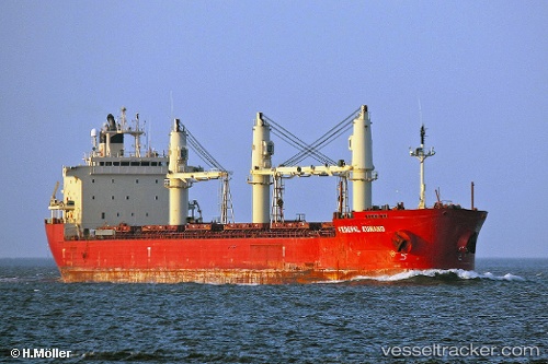
 Federal Kumano
Current Status
Where is the vessel?
Federal Kumano is currently in Near Algonac, based on AIS data received less than 1h ago.
Latest AIS update:
Current position: 42.55204° N, 82.58840° W (Near Algonac)
Average speed (last 7 days): Loading…
Average speed (last 30 days): Loading…
Vessel profile: Federal Kumano is a Bulk Carrier with dimensions 200m x 24m.
This page combines live AIS, route history, probable destination signals, nearby traffic, and port activity for practical vessel monitoring.
The current position of vessel Federal Kumano is 42.55204 lat / -82.58840 lng. Updated: 2026-05-15 19:19:04 UTCNearest reference points:
- Near Saint Clair Shores
- Near Walkerville
- Near Fort Gratiot
Currently sailing under the flag of Marshall Is ![]()
Federal Kumano built in 2003 year
Deadweight:
36489 tDetails:
Live Vessel Federal Kumano Analytics (details, animations, etc.)
Recent AIS points (UTC):
2026-05-15 16:07:32 UTC · 43.06629, -82.41514 · SOG 11.2 kn · COG 185°2026-05-15 16:18:52 UTC · 43.03104, -82.41624 · SOG 11.4 kn · COG 179°
2026-05-15 17:56:30 UTC · 42.76721, -82.46822 · SOG 10.5 kn · COG 184°
2026-05-15 19:19:04 UTC · 42.55204, -82.58840 · SOG 10.6 kn · COG 230°