 vesseltracker.com
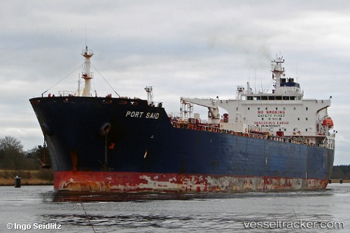
 VARSHA
Current Status
Where is the vessel?
VARSHA is currently in 16 nm S of Abu Musa, based on AIS data received about 9h ago.
Latest AIS update:
Current position: 25.60357° N, 55.09678° E (16 nm S of Abu Musa)
Average speed (last 7 days): Loading…
Average speed (last 30 days): Loading…
Vessel profile: VARSHA is a Chemical/Oil Products Tanker with dimensions 183m x 32m.
This page combines live AIS, route history, probable destination signals, nearby traffic, and port activity for practical vessel monitoring.
The current position of vessel VARSHA is 25.60357 lat / 55.09678 lng. Updated: 2026-05-13 18:23:05 UTCNearest reference points:
- 17 nm NW of Free Port
- Near Sharjah
- Near Free Port
Currently sailing under the flag of Panama ![]()
VARSHA built in 2003 year
Deadweight:
46211 tDetails:
Live Vessel VARSHA Analytics (details, animations, etc.)
Recent AIS points (UTC):
2026-05-13 18:23:05 UTC · 25.60357, 55.09678 · SOG 0.6 kn · COG 37°2026-05-13 18:23:05 UTC · 25.60357, 55.09678 · SOG 0.6 kn · COG 37°
2026-05-13 18:23:05 UTC · 25.60357, 55.09678 · SOG 0.6 kn · COG 37°
2026-05-13 18:23:05 UTC · 25.60357, 55.09678 · SOG 0.6 kn · COG 37°