 vesseltracker.com
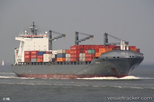
Lutetia
Current StatusWhere is the vessel?
Lutetia is currently in 18 nm S of Conakry, based on AIS data received less than 1h ago.
Latest AIS update:
Current position: 9.23299° N, 13.84151° W (18 nm S of Conakry)
Average speed (last 7 days): Loading…
Average speed (last 30 days): Loading…
Vessel profile: Lutetia is a Container Ship with dimensions 32m x 221m.
This page combines live AIS, route history, probable destination signals, nearby traffic, and port activity for practical vessel monitoring.
The current position of vessel Lutetia is 9.23299 lat / -13.84151 lng. Updated: 2026-05-16 10:07:51 UTCNearest reference points:
- 28 nm S of Conakry
- Near Conakry
- 49 nm S of Port de Boké
Details:
Live Vessel Lutetia Analytics (details, animations, etc.)
Recent AIS points (UTC):
2026-05-16 07:11:50 UTC · 9.23509, -13.83910 · SOG 0.2 kn · COG 294°2026-05-16 07:47:47 UTC · 9.23409, -13.83925 · SOG 0.3 kn · COG 305°
2026-05-16 10:01:53 UTC · 9.23298, -13.84138 · SOG 0.1 kn · COG 15°
2026-05-16 10:07:51 UTC · 9.23299, -13.84151 · SOG 0 kn · COG 18°