 vesseltracker.com
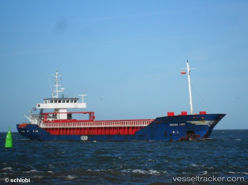
 OLYMP TRADER
Current Status
Where is the vessel?
OLYMP TRADER is currently in 10 nm N of de Ruyter, based on AIS data received about 1h ago.
Latest AIS update:
Current position: 52.46126° N, 4.13529° E (10 nm N of de Ruyter)
Average speed (last 7 days): Loading…
Average speed (last 30 days): Loading…
Vessel profile: OLYMP TRADER is a General Cargo with dimensions m x m.
This page combines live AIS, route history, probable destination signals, nearby traffic, and port activity for practical vessel monitoring.
The current position of vessel OLYMP TRADER is 52.46126 lat / 4.13529 lng. Updated: 2026-05-15 19:54:07 UTCNearest reference points:
- Near de Ruyter
- Near Ijmuiden
- 22 nm W of Schoorl
Currently sailing under the flag of Antigua and Barbuda ![]()
Details:
Live Vessel OLYMP TRADER Analytics (details, animations, etc.)
Recent AIS points (UTC):
2026-05-15 16:36:04 UTC · 52.46265, 4.13632 · SOG 0.4 kn · COG 299°2026-05-15 17:52:26 UTC · 52.46167, 4.13500 · SOG 0 kn · COG -1°
2026-05-15 19:06:05 UTC · 52.46146, 4.13490 · SOG 1.3 kn · COG 0°
2026-05-15 19:54:07 UTC · 52.46126, 4.13529 · SOG 0.7 kn · COG 342°