 vesseltracker.com
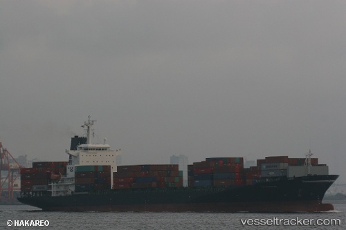
 LAKONIA
Current Status
Where is the vessel?
LAKONIA is currently in 11 nm SW of San Nicolas, based on AIS data received about 1h ago.
Latest AIS update:
Current position: 15.34560° S, 75.40861° W (11 nm SW of San Nicolas)
Average speed (last 7 days): Loading…
Average speed (last 30 days): Loading…
Vessel profile: LAKONIA is a Container Ship with dimensions m x m.
This page combines live AIS, route history, probable destination signals, nearby traffic, and port activity for practical vessel monitoring.
The current position of vessel LAKONIA is -15.34560 lat / -75.40861 lng. Updated: 2026-05-14 19:43:19 UTCNearest reference points:
- 110 nm SW of San Juan
Currently sailing under the flag of Liberia ![]()
Details:
Live Vessel LAKONIA Analytics (details, animations, etc.)
Recent AIS points (UTC):
2026-05-14 16:45:55 UTC · -15.71265, -74.87333 · SOG 13.5 kn · COG 302°2026-05-14 17:58:56 UTC · -15.56363, -75.10148 · SOG 12.8 kn · COG 302°
2026-05-14 19:35:29 UTC · -15.36402, -75.38715 · SOG 12.7 kn · COG 311°
2026-05-14 19:43:19 UTC · -15.34560, -75.40861 · SOG 12.7 kn · COG 311°