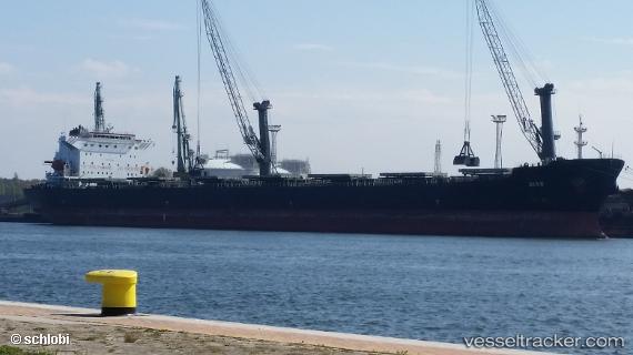
 CFL DEXING
Current Status
Where is the vessel?
CFL DEXING is currently in 11 nm SW of Siparia, based on AIS data received about 14h ago.
Latest AIS update:
Current position: 9.97186° N, 61.59860° W (11 nm SW of Siparia)
Average speed (last 7 days): Loading…
Average speed (last 30 days): Loading…
Vessel profile: CFL DEXING is a Bulk Carrier with dimensions m x m.
This page combines live AIS, route history, probable destination signals, nearby traffic, and port activity for practical vessel monitoring.
The current position of vessel CFL DEXING is 9.97186 lat / -61.59860 lng. Updated: 2026-05-23 13:46:56 UTCNearest reference points:
- Near POINT LISAS
- Near Carenage
- Near Caroni
Currently sailing under the flag of Panama ![]()
Details:
Live Vessel CFL DEXING Analytics (details, animations, etc.)
Recent AIS points (UTC):
2026-05-23 10:14:46 UTC · 9.97166, -61.59833 · SOG 0 kn · COG -1°2026-05-23 12:24:32 UTC · 9.97166, -61.59833 · SOG 0 kn · COG -1°
2026-05-23 13:39:58 UTC · 9.97166, -61.59833 · SOG 0 kn · COG -1°
2026-05-23 13:46:56 UTC · 9.97186, -61.59860 · SOG 0 kn · COG 85°