 vesseltracker.com
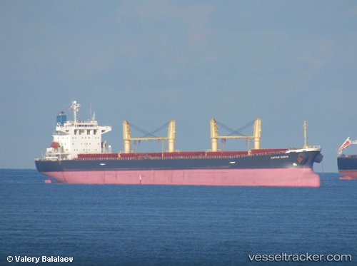
Xie Hai Yong Ning
Current StatusWhere is the vessel?
Xie Hai Yong Ning is currently in Near Jingjiang, based on AIS data received about 1h ago.
Latest AIS update:
Current position: 30.98671° N, 122.50821° E (Near Jingjiang)
Average speed (last 7 days): Loading…
Average speed (last 30 days): Loading…
Vessel profile: Xie Hai Yong Ning is a Bulk Carrier with dimensions 31m x 183m.
This page combines live AIS, route history, probable destination signals, nearby traffic, and port activity for practical vessel monitoring.
The current position of vessel Xie Hai Yong Ning is 30.98671 lat / 122.50821 lng. Updated: 2026-05-14 04:27:41 UTCNearest reference points:
- 14 nm N of Lü-hua Shan
- Near Lü-hua Shan
- Near Maji Shan
Details:
Live Vessel Xie Hai Yong Ning Analytics (details, animations, etc.)
Recent AIS points (UTC):
2026-05-14 01:44:06 UTC · 31.14874, 121.87976 · SOG 10.1 kn · COG 123°2026-05-14 01:49:58 UTC · 31.13914, 121.89580 · SOG 10.4 kn · COG 123°
2026-05-14 03:40:59 UTC · 31.02948, 122.30094 · SOG 14.1 kn · COG 94°
2026-05-14 04:27:41 UTC · 30.98671, 122.50821 · SOG 13.7 kn · COG 131°