 vesseltracker.com
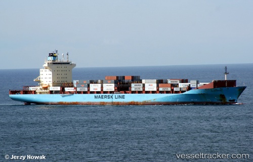
Olivia Maersk
Current StatusWhere is the vessel?
Olivia Maersk is currently in 55 nm N of Isla Grande, based on AIS data received less than 1h ago.
Latest AIS update:
Current position: 10.53251° N, 79.38092° W (55 nm N of Isla Grande)
Average speed (last 7 days): Loading…
Average speed (last 30 days): Loading…
Vessel profile: Olivia Maersk is a Container Ship with dimensions 32m x 238m.
This page combines live AIS, route history, probable destination signals, nearby traffic, and port activity for practical vessel monitoring.
The current position of vessel Olivia Maersk is 10.53251 lat / -79.38092 lng. Updated: 2026-05-14 17:58:34 UTCNearest reference points:
- Near Colon
- Near COLON 2000
- Near Colón Free Zone
Details:
Live Vessel Olivia Maersk Analytics (details, animations, etc.)
Recent AIS points (UTC):
2026-05-14 14:01:16 UTC · 10.57239, -79.32607 · SOG 2.3 kn · COG 104°2026-05-14 15:23:08 UTC · 10.56039, -79.34180 · SOG 1.1 kn · COG 334°
2026-05-14 16:37:17 UTC · 10.55538, -79.36041 · SOG 1.3 kn · COG 96°
2026-05-14 17:58:34 UTC · 10.53251, -79.38092 · SOG 1.4 kn · COG 134°