 vesseltracker.com
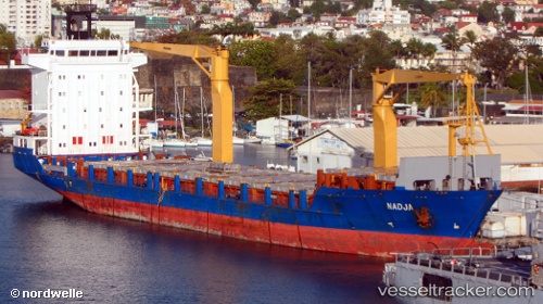
Nadja
Current StatusWhere is the vessel?
Nadja is currently in 171 nm NE of Enmore, based on AIS data received about 1h ago.
Latest AIS update:
Current position: 8.92695° N, 56.09790° W (171 nm NE of Enmore)
Average speed (last 7 days): Loading…
Average speed (last 30 days): Loading…
Vessel profile: Nadja is a Container Ship with dimensions 20m x 123m.
This page combines live AIS, route history, probable destination signals, nearby traffic, and port activity for practical vessel monitoring.
The current position of vessel Nadja is 8.92695 lat / -56.09790 lng. Updated: 2026-05-14 20:16:25 UTCNearest reference points:
- 57 nm NE of Adventure
Details:
Live Vessel Nadja Analytics (details, animations, etc.)
Recent AIS points (UTC):
2026-05-14 08:14:17 UTC · 7.44404, -54.27252 · SOG 13 kn · COG 316°2026-05-14 08:14:17 UTC · 7.44404, -54.27252 · SOG 13 kn · COG 316°
2026-05-14 20:16:25 UTC · 8.92695, -56.09790 · SOG 12.2 kn · COG 310°
2026-05-14 20:16:25 UTC · 8.92695, -56.09790 · SOG 12.2 kn · COG 310°