 vesseltracker.com
 Sl Kamagong
Current Status
Where is the vessel?
Sl Kamagong is currently in Near Lapu-Lapu, Cebu, based on AIS data received about 1h ago.
Latest AIS update:
Current position: 10.32125° N, 123.95728° E (Near Lapu-Lapu, Cebu)
Average speed (last 7 days): Loading…
Average speed (last 30 days): Loading…
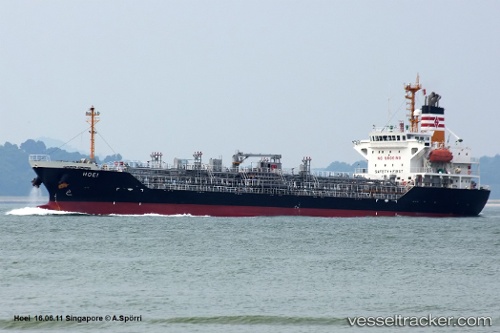
Vessel profile: Sl Kamagong is a Chemical Oil Products Tanker with dimensions 114m x 114m.
This page combines live AIS, route history, probable destination signals, nearby traffic, and port activity for practical vessel monitoring.
The current position of vessel Sl Kamagong is 10.32125 lat / 123.95728 lng. Updated: 2026-05-14 14:01:37 UTCNearest reference points:
- Near Mandaue, Cebu
- Near Mandaue City
- Near Danao
Currently sailing under the flag of Philippines ![]()
Sl Kamagong built in 2001 year
Deadweight:
8756 tDetails:
Live Vessel Sl Kamagong Analytics (details, animations, etc.)
Recent AIS points (UTC):
2026-05-14 10:01:35 UTC · 10.32123, 123.95730 · SOG 0 kn · COG 63°2026-05-14 11:55:36 UTC · 10.32123, 123.95728 · SOG 0 kn · COG 63°
2026-05-14 13:10:37 UTC · 10.32125, 123.95728 · SOG 0 kn · COG 63°
2026-05-14 14:01:37 UTC · 10.32125, 123.95728 · SOG 0 kn · COG 63°