 vesseltracker.com
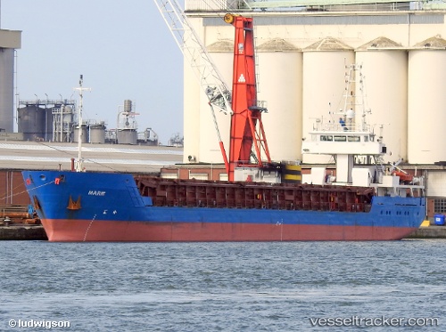
 Marie
Marie
Current Status
Where is the vessel?
Marie is currently in Near Ambleteuse, based on AIS data received about 2h ago.
Latest AIS update:
Current position: 50.83416° N, 1.46430° E (Near Ambleteuse)
Average speed (last 7 days): Loading…
Average speed (last 30 days): Loading…
Vessel profile: Marie is a General Cargo Ship with dimensions 89m x 12m.
This page combines live AIS, route history, probable destination signals, nearby traffic, and port activity for practical vessel monitoring.
The current position of vessel Marie is 50.83416 lat / 1.46430 lng. Updated: 2026-05-15 01:15:33 UTCNearest reference points:
- Near Le Portel
- Near BOULOGNE-SUR-MER
- Near Dover
Currently sailing under the flag of Belgium ![]()
Marie built in 2002 year
Deadweight:
2974 tDetails:
Live Vessel Marie Analytics (details, animations, etc.)
Recent AIS points (UTC):
2026-05-14 21:59:08 UTC · 50.44812, 0.89125 · SOG 10.1 kn · COG 79°2026-05-14 22:37:23 UTC · 50.49238, 1.04347 · SOG 10.2 kn · COG 53°
2026-05-14 23:58:53 UTC · 50.64628, 1.31098 · SOG 9.9 kn · COG 55°
2026-05-15 01:15:33 UTC · 50.83416, 1.46430 · SOG 10.1 kn · COG 21°