 vesseltracker.com
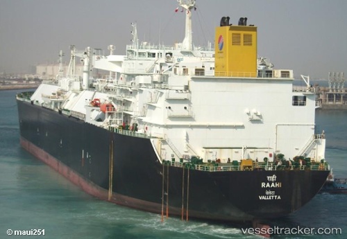
Raahi
Current StatusWhere is the vessel?
Raahi is currently in 41 nm SW of Jodhpur, based on AIS data received about 1h ago.
Latest AIS update:
Current position: 21.33270° N, 69.59190° E (41 nm SW of Jodhpur)
Average speed (last 7 days): Loading…
Average speed (last 30 days): Loading…
Vessel profile: Raahi is a Lng Tanker with dimensions 44m x 277m.
This page combines live AIS, route history, probable destination signals, nearby traffic, and port activity for practical vessel monitoring.
The current position of vessel Raahi is 21.3327 lat / 69.5919 lng. Updated: 2026-05-14 05:59:56 UTCNearest reference points:
- 54 nm S of Positra
- 49 nm S of Positra
- Near Khambhaliya
Details:
Live Vessel Raahi Analytics (details, animations, etc.)
Recent AIS points (UTC):
2026-05-14 01:56:57 UTC · 21.33340, 69.59210 · SOG 0 kn · COG 281°2026-05-14 03:50:57 UTC · 21.33340, 69.59210 · SOG 0.2 kn · COG 284°
2026-05-14 04:41:56 UTC · 21.33330, 69.59200 · SOG 0.1 kn · COG 288°
2026-05-14 05:59:56 UTC · 21.33270, 69.59190 · SOG 0.1 kn · COG 306°