 vesseltracker.com
 ANKARA
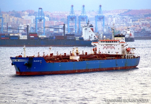
Current Status
Where is the vessel?
ANKARA is currently in Near Polychnitos Lesvou, based on AIS data received less than 1h ago.
Latest AIS update:
Current position: 34.24090° N, 26.26702° E (Near Polychnitos Lesvou)
Average speed (last 7 days): Loading…
Average speed (last 30 days): Loading…
Vessel profile: ANKARA is a Chemical Oil Products Tanker with dimensions 176m x 31m.
This page combines live AIS, route history, probable destination signals, nearby traffic, and port activity for practical vessel monitoring.
The current position of vessel ANKARA is 34.24090 lat / 26.26702 lng. Updated: 2026-05-14 07:26:14 UTCNearest reference points:
- Near Iraklion
- Near Kali Limenes
- 67 nm S of Kali Limenes
Currently sailing under the flag of Panama ![]()
ANKARA built in 2004 year
Deadweight:
40083 tDetails:
Live Vessel ANKARA Analytics (details, animations, etc.)
Recent AIS points (UTC):
2026-05-14 05:07:03 UTC · 34.34339, 26.78154 · SOG 11.5 kn · COG 258°2026-05-14 05:58:53 UTC · 34.30467, 26.58763 · SOG 11.3 kn · COG 257°
2026-05-14 07:23:15 UTC · 34.24337, 26.27772 · SOG 11 kn · COG 256°
2026-05-14 07:26:14 UTC · 34.24090, 26.26702 · SOG 11 kn · COG 256°