 vesseltracker.com
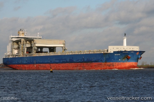
 Okiana
Current Status
Where is the vessel?
Okiana is currently in 48 nm S of Cleghorn, based on AIS data received about 1h ago.
Latest AIS update:
Current position: 54.93170° N, 3.23807° E (48 nm S of Cleghorn)
Average speed (last 7 days): Loading…
Average speed (last 30 days): Loading…
Vessel profile: Okiana is a Bulk Carrier with dimensions 213m x 32m.
This page combines live AIS, route history, probable destination signals, nearby traffic, and port activity for practical vessel monitoring.
The current position of vessel Okiana is 54.93170 lat / 3.23807 lng. Updated: 2026-05-13 23:47:10 UTCNearest reference points:
- 26 nm W of Cleghorn
- 19 nm NW of Neeltje Jans
- Near Neeltje Jans
Currently sailing under the flag of United Kingdom ![]()
Okiana built in 2004 year
Deadweight:
48712 tDetails:
Live Vessel Okiana Analytics (details, animations, etc.)
Recent AIS points (UTC):
2026-05-13 06:33:20 UTC · 57.31570, -0.88249 · SOG 12 kn · COG 151°2026-05-13 06:33:20 UTC · 57.31570, -0.88249 · SOG 12 kn · COG 151°
2026-05-13 06:33:20 UTC · 57.31570, -0.88249 · SOG 12 kn · COG 151°
2026-05-13 23:47:10 UTC · 54.93170, 3.23807 · SOG 11.4 kn · COG 152°