 vesseltracker.com
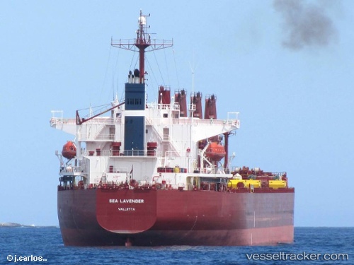
Sea Lavender
Current StatusWhere is the vessel?
Sea Lavender is currently in 14 nm NW of Ashdod, based on AIS data received about 1h ago.
Latest AIS update:
Current position: 31.94990° N, 34.39970° E (14 nm NW of Ashdod)
Average speed (last 7 days): Loading…
Average speed (last 30 days): Loading…
Vessel profile: Sea Lavender is a Bulk Carrier with dimensions 32m x 190m.
This page combines live AIS, route history, probable destination signals, nearby traffic, and port activity for practical vessel monitoring.
The current position of vessel Sea Lavender is 31.9499 lat / 34.3997 lng. Updated: 2026-04-30 07:49:03 UTCNearest reference points:
- 22 nm W of Haifa Granaries
- Near AL ARISH
- Near Haifa
Details:
Live Vessel Sea Lavender Analytics (details, animations, etc.)
Recent AIS points (UTC):
2026-04-30 03:31:59 UTC · 31.99740, 34.40440 · SOG 0.5 kn · COG 18°2026-04-30 04:24:50 UTC · 32.00460, 34.40860 · SOG 1.8 kn · COG 27°
2026-04-30 07:02:04 UTC · 31.95060, 34.39700 · SOG 1.6 kn · COG 208°
2026-04-30 07:49:03 UTC · 31.94990, 34.39970 · SOG 0.4 kn · COG 247°