 vesseltracker.com
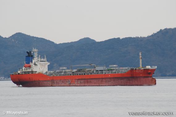
 LINK OCEAN 1
Current Status
Where is the vessel?
LINK OCEAN 1 is currently in Near Madura Terminal, based on AIS data received less than 1h ago.
Latest AIS update:
Current position: 6.86637° S, 112.81631° E (Near Madura Terminal)
Average speed (last 7 days): Loading…
Average speed (last 30 days): Loading…
Vessel profile: LINK OCEAN 1 is a Tanker with dimensions m x m.
This page combines live AIS, route history, probable destination signals, nearby traffic, and port activity for practical vessel monitoring.
The current position of vessel LINK OCEAN 1 is -6.86637 lat / 112.81631 lng. Updated: 2026-05-15 11:36:13 UTCNearest reference points:
- 11 nm W of Madura Terminal
- Near Bangkalan
- 10 nm W of Poleng
Currently sailing under the flag of Indonesia ![]()
Details:
Live Vessel LINK OCEAN 1 Analytics (details, animations, etc.)
Recent AIS points (UTC):
2026-05-15 07:57:07 UTC · -6.86646, 112.81637 · SOG 0 kn · COG -1°2026-05-15 10:15:11 UTC · -6.86639, 112.81633 · SOG 0.1 kn · COG -1°
2026-05-15 11:00:12 UTC · -6.86639, 112.81629 · SOG 0 kn · COG -1°
2026-05-15 11:36:13 UTC · -6.86637, 112.81631 · SOG 0.1 kn · COG -1°