 vesseltracker.com
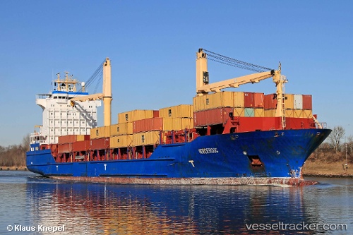
 MSC NORDEROOG F
Current Status
Where is the vessel?
MSC NORDEROOG F is currently in Near Freeport, based on AIS data received about 2h ago.
Latest AIS update:
Current position: 26.52470° N, 78.76622° W (Near Freeport)
Average speed (last 7 days): Loading…
Average speed (last 30 days): Loading…
Vessel profile: MSC NORDEROOG F is a Container Ship with dimensions 161m x 25m.
This page combines live AIS, route history, probable destination signals, nearby traffic, and port activity for practical vessel monitoring.
The current position of vessel MSC NORDEROOG F is 26.52470 lat / -78.76622 lng. Updated: 2026-03-29 19:36:52 UTCNearest reference points:
- 44 nm S of Freeport
- 44 nm E of Surfside
- Near Palm Beach
Currently sailing under the flag of Liberia ![]()
MSC NORDEROOG F built in 2004 year
Deadweight:
16921 tDetails:
Live Vessel MSC NORDEROOG F Analytics (details, animations, etc.)
Recent AIS points (UTC):
2026-03-29 13:50:46 UTC · 26.13667, -78.65765 · SOG 5.1 kn · COG 339°2026-03-29 15:34:56 UTC · 26.26378, -78.74841 · SOG 5.2 kn · COG 336°
2026-03-29 17:55:04 UTC · 26.41456, -78.78194 · SOG 1.7 kn · COG 2°
2026-03-29 19:36:52 UTC · 26.52470, -78.76622 · SOG 1.5 kn · COG 1°