 vesseltracker.com
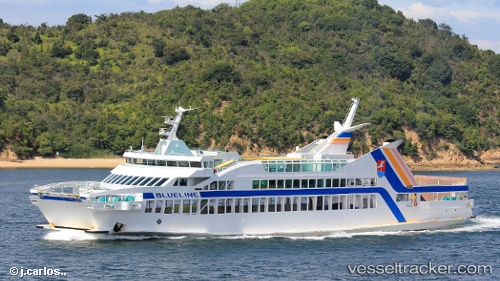
 VANUATU FERRY2
Current Status
Where is the vessel?
VANUATU FERRY2 is currently in 16 nm S of PORT VILA, based on AIS data received less than 1h ago.
Latest AIS update:
Current position: 17.99621° S, 168.37074° E (16 nm S of PORT VILA)
Average speed (last 7 days): Loading…
Average speed (last 30 days): Loading…
Vessel profile: VANUATU FERRY2 is a Passenger A with dimensions m x m.
This page combines live AIS, route history, probable destination signals, nearby traffic, and port activity for practical vessel monitoring.
The current position of vessel VANUATU FERRY2 is -17.99621 lat / 168.37074 lng. Updated: 2026-04-27 05:56:49 UTCNearest reference points:
- 39 nm E of Ouvea
Currently sailing under the flag of Vanuatu ![]()
Details:
Live Vessel VANUATU FERRY2 Analytics (details, animations, etc.)
Recent AIS points (UTC):
2026-04-27 02:03:48 UTC · -17.75499, 168.31197 · SOG 0 kn · COG 125°2026-04-27 04:26:18 UTC · -17.81506, 168.26225 · SOG 8 kn · COG 149°
2026-04-27 04:48:17 UTC · -17.85994, 168.28850 · SOG 8.4 kn · COG 145°
2026-04-27 05:56:49 UTC · -17.99621, 168.37074 · SOG 8.4 kn · COG 145°