 vesseltracker.com
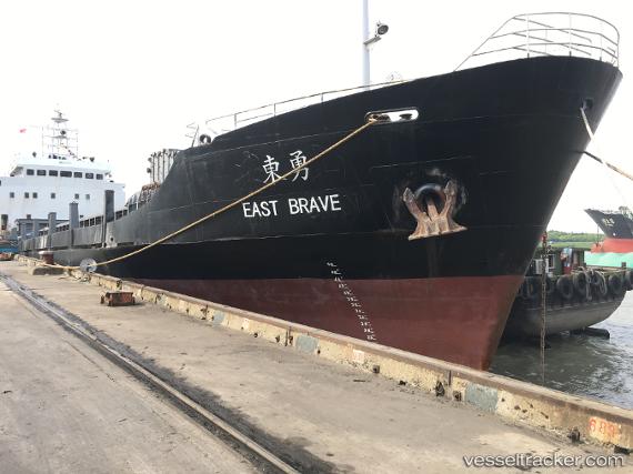
 East Brave
Current Status
Where is the vessel?
East Brave is currently in Open sea (no nearby ports in database), based on AIS data received about 104d ago.
Latest AIS update:
Current position: 42.93563° S, 105.20477° E (Open sea (no nearby ports in database))
Average speed (last 7 days): Loading…
Average speed (last 30 days): Loading…
Vessel profile: East Brave is a Container Ship with dimensions 75m x 14m.
This page combines live AIS, route history, probable destination signals, nearby traffic, and port activity for practical vessel monitoring.
The current position of vessel East Brave is -42.93563 lat / 105.20477 lng. Updated: 2026-01-29 22:31:25 UTCNearest reference points:
- Open sea (no nearby ports in database)
- Open sea, approx. 572 nm off the nearest listed port
- Open sea, approx. 533 nm off the nearest listed port
Currently sailing under the flag of Sierra Leone ![]()
Details:
Live Vessel East Brave Analytics (details, animations, etc.)
Recent AIS points (UTC):
2026-01-29 22:31:25 UTC · -42.93563, 105.20477 · SOG 89.7 kn · COG 32°