 vesseltracker.com
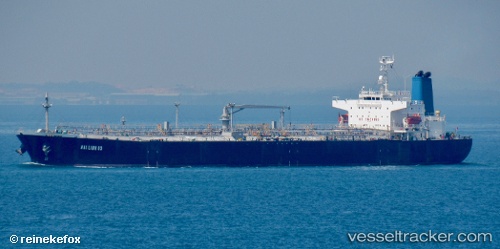
 AURORA
Current Status
Where is the vessel?
AURORA is currently in 47 nm S of Polychnitos Lesvou, based on AIS data received less than 1h ago.
Latest AIS update:
Current position: 33.31270° N, 26.12537° E (47 nm S of Polychnitos Lesvou)
Average speed (last 7 days): Loading…
Average speed (last 30 days): Loading…
Vessel profile: AURORA is a Oil Products Tanker with dimensions m x m.
This page combines live AIS, route history, probable destination signals, nearby traffic, and port activity for practical vessel monitoring.
The current position of vessel AURORA is 33.31270 lat / 26.12537 lng. Updated: 2026-05-14 00:14:10 UTCNearest reference points:
- 67 nm S of Kali Limenes
- 91 nm SE of Polychnitos Lesvou
- Near Kali Limenes
Currently sailing under the flag of Sao Tome and Principe ![]()
Details:
Live Vessel AURORA Analytics (details, animations, etc.)
Recent AIS points (UTC):
2026-05-13 20:15:59 UTC · 33.55409, 25.16430 · SOG 12.8 kn · COG 111°2026-05-13 21:34:00 UTC · 33.47163, 25.48329 · SOG 13.1 kn · COG 107°
2026-05-13 22:43:40 UTC · 33.40303, 25.76903 · SOG 12.4 kn · COG 109°
2026-05-14 00:14:10 UTC · 33.31270, 26.12537 · SOG 12.7 kn · COG 109°