 vesseltracker.com
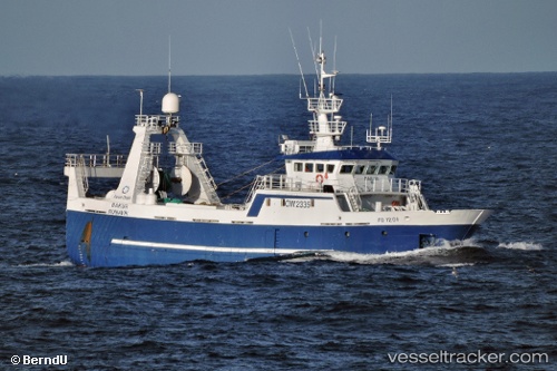
 Bakur
Bakur
Current Status
Where is the vessel?
Bakur is currently in Near Eidi, based on AIS data received about 1h ago.
Latest AIS update:
Current position: 62.41167° N, 7.23167° W (Near Eidi)
Average speed (last 7 days): Loading…
Average speed (last 30 days): Loading…
Vessel profile: Bakur is a Fishing Vessel with dimensions 38m x 10m.
This page combines live AIS, route history, probable destination signals, nearby traffic, and port activity for practical vessel monitoring.
The current position of vessel Bakur is 62.41167 lat / -7.23167 lng. Updated: 2026-05-13 23:33:15 UTCNearest reference points:
- Near VESTMANNA
- Near FUGLAFJORDUR
- 37 nm NW of Eidi
Currently sailing under the flag of Faroe Is ![]()
Bakur built in 2002 year
Details:
Live Vessel Bakur Analytics (details, animations, etc.)
Recent AIS points (UTC):
2026-05-13 19:39:52 UTC · 62.05655, -6.66356 · SOG 10 kn · COG 34°2026-05-13 22:09:32 UTC · 62.32799, -6.82158 · SOG 9.5 kn · COG 328°
2026-05-13 22:17:11 UTC · 62.33920, -6.85507 · SOG 9.3 kn · COG 300°
2026-05-13 23:33:15 UTC · 62.41167, -7.23167 · SOG 9 kn · COG -1°