 vesseltracker.com
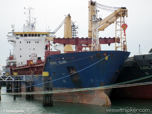
 Atlantic Island
Current Status
Where is the vessel?
Atlantic Island is currently in Near Town Quays/Drogheda, based on AIS data received less than 1h ago.
Latest AIS update:
Current position: 53.63413° N, 6.20230° E (Near Town Quays/Drogheda)
Average speed (last 7 days): Loading…
Average speed (last 30 days): Loading…
Vessel profile: Atlantic Island is a General Cargo Ship with dimensions 95m x 95m.
This page combines live AIS, route history, probable destination signals, nearby traffic, and port activity for practical vessel monitoring.
The current position of vessel Atlantic Island is 53.63413 lat / 6.20230 lng. Updated: 2026-05-13 21:49:37 UTCNearest reference points:
- 14 nm NW of Town Quays/Drogheda
- Near Hoogkerk
- Near De Wilgen
Currently sailing under the flag of Cyprus ![]()
Atlantic Island built in 2002 year
Deadweight:
5000 tDetails:
Live Vessel Atlantic Island Analytics (details, animations, etc.)
Recent AIS points (UTC):
2026-05-13 17:24:30 UTC · 53.63387, 6.20660 · SOG 0 kn · COG 295°2026-05-13 19:47:37 UTC · 53.63400, 6.20571 · SOG 0.1 kn · COG 309°
2026-05-13 19:53:35 UTC · 53.63379, 6.20526 · SOG 0.3 kn · COG 332°
2026-05-13 21:49:37 UTC · 53.63413, 6.20230 · SOG 0 kn · COG 73°