 vesseltracker.com
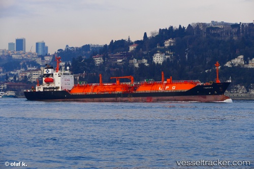
 SEGULL
Current Status
Where is the vessel?
SEGULL is currently in 13 nm NE of Istanbul New Airport, based on AIS data received less than 1h ago.
Latest AIS update:
Current position: 41.45910° N, 28.90311° E (13 nm NE of Istanbul New Airport)
Average speed (last 7 days): Loading…
Average speed (last 30 days): Loading…
Vessel profile: SEGULL is a LPG Tanker with dimensions 19m x 117m.
This page combines live AIS, route history, probable destination signals, nearby traffic, and port activity for practical vessel monitoring.
The current position of vessel SEGULL is 41.45910 lat / 28.90311 lng. Updated: 2026-05-17 07:44:33 UTCNearest reference points:
- Near RUMELI FENERI
- 18 nm N of Istanbul New Airport
- Near Istinye/Istambul
Currently sailing under the flag of Vietnam ![]()
SEGULL built in 2002 year
Deadweight:
6017 tDetails:
Live Vessel SEGULL Analytics (details, animations, etc.)
Recent AIS points (UTC):
2026-05-17 04:31:34 UTC · 41.46293, 28.92188 · SOG 0.4 kn · COG 311°2026-05-17 06:20:32 UTC · 41.46420, 28.91324 · SOG 0.4 kn · COG 327°
2026-05-17 07:22:14 UTC · 41.46053, 28.90620 · SOG 0.3 kn · COG 339°
2026-05-17 07:44:33 UTC · 41.45910, 28.90311 · SOG 0.5 kn · COG 343°