 vesseltracker.com
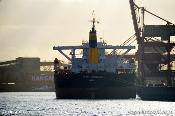
 New Leonidas
Current Status
Where is the vessel?
New Leonidas is currently in 94 nm N of Suqutrá, based on AIS data received about 2h ago.
Latest AIS update:
Current position: 13.99500° N, 54.48833° E (94 nm N of Suqutrá)
Average speed (last 7 days): Loading…
Average speed (last 30 days): Loading…
Vessel profile: New Leonidas is a Bulk Carrier with dimensions 289m x 289m.
This page combines live AIS, route history, probable destination signals, nearby traffic, and port activity for practical vessel monitoring.
The current position of vessel New Leonidas is 13.99500 lat / 54.48833 lng. Updated: 2026-05-13 19:45:47 UTCNearest reference points:
- 103 nm S of Port Raysut
- 110 nm NE of Gross Koris
- 106 nm S of Port Raysut
Currently sailing under the flag of Liberia ![]()
New Leonidas built in 2003 year
Deadweight:
170578 tDetails:
Live Vessel New Leonidas Analytics (details, animations, etc.)
Recent AIS points (UTC):
2026-05-13 16:42:42 UTC · 13.81833, 55.07167 · SOG 11 kn · COG -1°2026-05-13 18:18:10 UTC · 13.91335, 54.77179 · SOG 11.8 kn · COG 284°
2026-05-13 19:43:30 UTC · 13.99421, 54.49705 · SOG 11.8 kn · COG 282°
2026-05-13 19:45:47 UTC · 13.99500, 54.48833 · SOG 11 kn · COG -1°