 vesseltracker.com
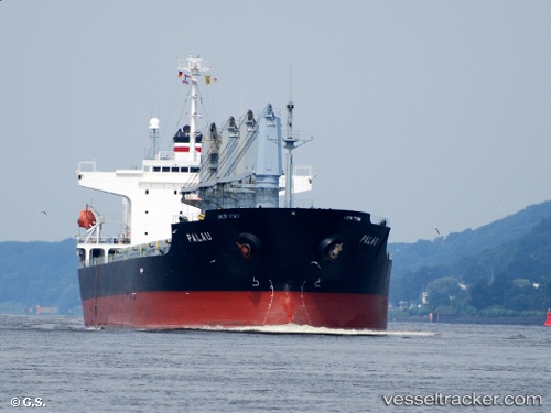
 PALAU
PALAU
Current Status
Where is the vessel?
PALAU is currently in 33 nm SE of Campha, based on AIS data received less than 1h ago.
Latest AIS update:
Current position: 20.63667° N, 107.79167° E (33 nm SE of Campha)
Average speed (last 7 days): Loading…
Average speed (last 30 days): Loading…
Vessel profile: PALAU is a Bulk Carrier with dimensions m x m.
This page combines live AIS, route history, probable destination signals, nearby traffic, and port activity for practical vessel monitoring.
The current position of vessel PALAU is 20.63667 lat / 107.79167 lng. Updated: 2026-05-15 11:12:08 UTCNearest reference points:
- 24 nm SE of Campha
- 35 nm S of Campha
- 13 nm E of Campha
Currently sailing under the flag of Liberia ![]()
Details:
Live Vessel PALAU Analytics (details, animations, etc.)
Recent AIS points (UTC):
2026-05-15 08:21:08 UTC · 20.63667, 107.79333 · SOG 0 kn · COG -1°2026-05-15 10:21:08 UTC · 20.63667, 107.79167 · SOG 0 kn · COG -1°
2026-05-15 11:00:11 UTC · 20.63667, 107.79167 · SOG 0 kn · COG -1°
2026-05-15 11:12:08 UTC · 20.63667, 107.79167 · SOG 0 kn · COG -1°