 vesseltracker.com
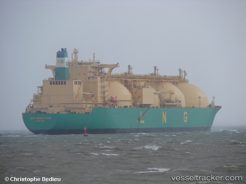
Lng Cross River
Current StatusWhere is the vessel?
Lng Cross River is currently in 89 nm S of Maspalomas, based on AIS data received less than 1h ago.
Latest AIS update:
Current position: 26.28578° N, 15.26738° W (89 nm S of Maspalomas)
Average speed (last 7 days): Loading…
Average speed (last 30 days): Loading…
Vessel profile: Lng Cross River is a Lng Tanker with dimensions 48m x 288m.
This page combines live AIS, route history, probable destination signals, nearby traffic, and port activity for practical vessel monitoring.
The current position of vessel Lng Cross River is 26.28578 lat / -15.26738 lng. Updated: 2026-05-16 10:06:03 UTCNearest reference points:
- 33 nm SE of San Agustin
- 22 nm S of San Agustin
- Near TALIARTE
Details:
Live Vessel Lng Cross River Analytics (details, animations, etc.)
Recent AIS points (UTC):
2026-05-16 07:11:42 UTC · 25.87299, -15.67199 · SOG 11.6 kn · COG 42°2026-05-16 07:47:11 UTC · 25.95758, -15.58929 · SOG 11.6 kn · COG 42°
2026-05-16 10:03:07 UTC · 26.27833, -15.27333 · SOG 11 kn · COG -1°
2026-05-16 10:06:03 UTC · 26.28578, -15.26738 · SOG 11.2 kn · COG 41°