 vesseltracker.com
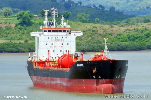
Duke
Current StatusWhere is the vessel?
Duke is currently in 18 nm SW of Port Harcourt, based on AIS data received about 2d ago.
Latest AIS update:
Current position: 4.53056° N, 6.81487° E (18 nm SW of Port Harcourt)
Average speed (last 7 days): Loading…
Average speed (last 30 days): Loading…
Vessel profile: Duke is a Chemical Oil Products Tanker with dimensions 23m x 140m.
This page combines live AIS, route history, probable destination signals, nearby traffic, and port activity for practical vessel monitoring.
The current position of vessel Duke is 4.53056 lat / 6.81487 lng. Updated: 2026-05-15 03:00:02 UTCNearest reference points:
- Near Port Harcourt
- 21 nm SW of Bonny
- Near Bonny
Details:
Live Vessel Duke Analytics (details, animations, etc.)
Recent AIS points (UTC):
2026-05-15 03:00:02 UTC · 4.53056, 6.81487 · SOG 0 kn · COG 330°2026-05-15 03:00:02 UTC · 4.53056, 6.81487 · SOG 0 kn · COG 330°
2026-05-15 03:00:02 UTC · 4.53056, 6.81487 · SOG 0 kn · COG 330°
2026-05-15 03:00:02 UTC · 4.53056, 6.81487 · SOG 0 kn · COG 330°