 vesseltracker.com
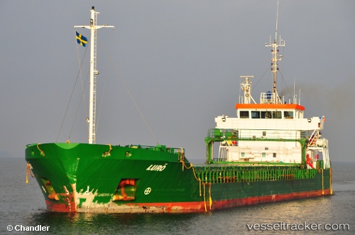
 Luro
Luro
Current Status
Where is the vessel?
Luro is currently in 19 nm W of Schoorl, based on AIS data received about 2h ago.
Latest AIS update:
Current position: 52.77712° N, 4.12010° E (19 nm W of Schoorl)
Average speed (last 7 days): Loading…
Average speed (last 30 days): Loading…
Vessel profile: Luro is a General Cargo Ship with dimensions 89m x 14m.
This page combines live AIS, route history, probable destination signals, nearby traffic, and port activity for practical vessel monitoring.
The current position of vessel Luro is 52.77712 lat / 4.12010 lng. Updated: 2026-04-16 13:20:28 UTCNearest reference points:
- 22 nm W of Schoorl
- 23 nm N of de Ruyter
- Near de Ruyter
Currently sailing under the flag of Netherlands ![]()
Luro built in 2003 year
Deadweight:
4919 tDetails:
Live Vessel Luro Analytics (details, animations, etc.)
Recent AIS points (UTC):
2026-04-16 08:18:35 UTC · 52.25517, 3.33195 · SOG 7.4 kn · COG 43°2026-04-16 09:26:07 UTC · 52.35688, 3.49561 · SOG 7.8 kn · COG 44°
2026-04-16 11:32:06 UTC · 52.55479, 3.83358 · SOG 8.7 kn · COG 46°
2026-04-16 13:20:28 UTC · 52.77712, 4.12010 · SOG 9.6 kn · COG 43°